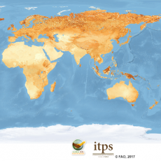
Global Soil Organic Carbon Map
December 29, 2017
From our point of view, the main principles are:
- Reserves for the mineral soil layer and organic soil layer are calculated separately (with possible separation of the organic layer into litter and peat layer). All three layers are summed in the final map.
- The initial data for the calculations are:
- Сontent of organic carbon (OC) in a layer depth to 30 cm, % (for soil cut or soil map contour);
- Bulk density, g/cm³ (for soil cut or soil map contour);
- Degree of stoniness, % or gradation (for soil cut or soil map contour);
- The result for every national map is grid with a step of 1x1 km (more precise, with a step of ½ of the angular second or 1/120 degrees). The grid calculation is carried out by the methods of ordinary interpolation, digital soil mapping or their combination depending on the initial data set, i.e. legacy soil maps, soil descriptions of reference profiles, agrochemical studies.
- The accuracy «validation» map for estimation of calculation accuracy of the main map is presented in the same format;
- The FAO Global Soil Partnership Secretariat in conjunction with the ISRIC carried out the cross–linking of national maps into a global map using single masks of reservoirs, administrative boundaries, etc. Therefore, variances in summarized data for individual state are insignificant.
Researches to assess the reserves of organic carbon in soils and their cartographic mapping are common for Russian soil science (Orlov and others, 1996; Rozhkov and others, 1997; Stolbovoy, 2002; Titlyanova and others, 1998; Schepaschenko and others, 2013).
However due to the vast territory and a huge variety of natural conditions of Russia the map-making of a carbon reserve map in accordance with the declared program principles of the GSOC17 is possible only with the coordinated cooperation of the efforts of the teams from many scientific and agro–industrial organizations.
The Soil Data Center of the M.V.Lomonosov Moscow State University is the coordinator of map–making of a carbon reserve map of Russia. The Soil Data Center of Moscow State University initiated the exchange of different–scale soil data within a distributed network of regional soil data centers. This network in Russia is currently in process of formation.
All operations are carried out on the basis of the «Information system Soil–geographic database of Russia» (ISSGDB) in accordance with the ideology of the FAO Global Soil Partnership program.
More detailed information on the implementation of this initiative in Russia is given in the section «Map of organic carbon stocks in the 30-cm layer of Russian soils».